These data update automatically every 30 minutes
Last update: May 03, 2017 20:32:45 UTC
Seismograms may take several moments to load. Click on a plot to see larger image.
-
CU/ANWB Willy Bob, Antigua and Barbuda 
-
CU/BBGH Gun Hill, Barbados 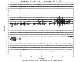
-
CU/BCIP Isla Barro Colorado, Panama 
-
CU/GRGR Grenville, Grenada 
-
CU/GRTK Grand Turk, Turks and Caicos Islands 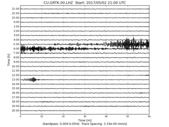
-
CU/GTBY Guantanamo Bay, Cuba 
-
CU/MTDJ Mount Denham, Jamaica 
-
CU/SDDR Presa de Sabenta, Dominican Republic 
-
CU/TGUH Tegucigalpa, Honduras 
-
IC/BJT Baijiatuan, Beijing, China 
-
IC/ENH Enshi, Hubei Province, China 
-
IC/HIA Hailar, Neimenggu Autonomous Region, China 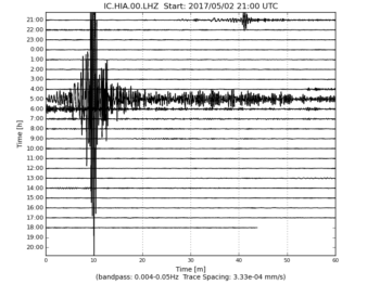
-
IC/KMI Kunming, Yunnan Province, China 
-
IC/LSA Tibet, China 
-
IC/MDJ Mudanjiang, Heilongjiang Province, China 
-
IC/QIZ Qiongzhong, Hainan Province, China 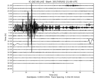
-
IC/SSE Shanghai, China 
-
IC/WMQ Urumqi, Xinjiang Province, China 
-
IC/XAN Xi'an, China 
-
IU/ADK Adak, Aleutian Islands, Alaska 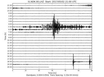
-
IU/AFI Afiamalu, Samoa 
-
IU/ANMO Albuquerque, New Mexico, USA 
-
IU/ANTO Ankara, Turkey 
-
IU/BBSR Bermuda Institute of Ocean Sciences, St George's Bermuda 
-
IU/BILL Bilibino, Russia 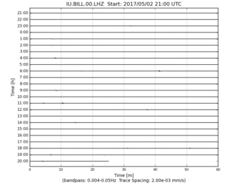
-
IU/CASY Casey, Antarctica 
-
IU/CCM Cathedral Cave, Missouri, USA 
-
IU/CHTO Chiang Mai, Thailand 
-
IU/COLA College Outpost, Alaska, USA 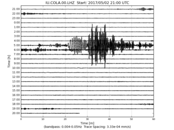
-
IU/COR Corvallis, Oregon, USA 
-
IU/CTAO Charters Towers, Australia 
-
IU/DAV Davao, Philippines 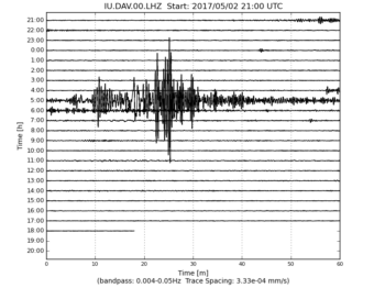
-
IU/DWPF Disney Wilderness Preserve, Florida, USA 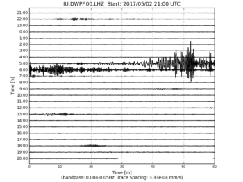
-
IU/FUNA Funafuti, Tuvalu 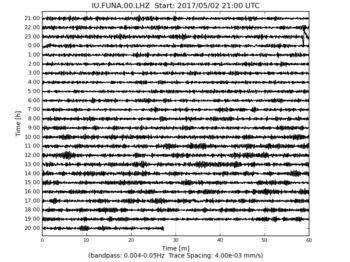
-
IU/FURI Mt. Furi, Ethiopia 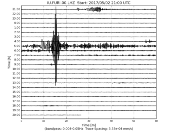
-
IU/GNI Garni, Armenia 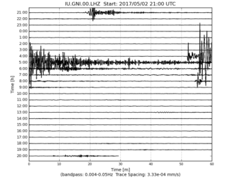
-
IU/GRFO Grafenberg, Germany 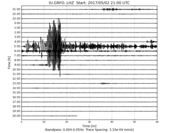
-
IU/GUMO Guam, Mariana Islands 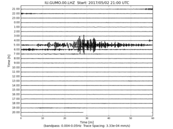
-
IU/HKT Hockley, Texas 
-
IU/HNR Honiara, Solomon Islands 
-
IU/HRV Adam Dziewonski Observatory (Oak Ridge), Massachusetts, USA 
-
IU/INCN Inchon, Republic of Korea 
-
IU/JOHN Johnston Island, USA 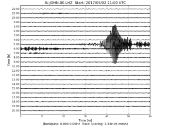
-
IU/KBL Kabul, Afghanistan 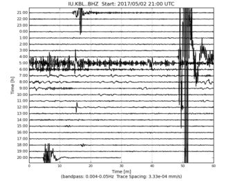
-
IU/KBS Ny-Alesund, Spitzbergen, Norway 
-
IU/KEV Kevo, Finland 
-
IU/KIEV Kiev, Ukraine 
-
IU/KIP Kipapa, Hawaii, USA 
-
IU/KMBO Kilima Mbogo, Kenya 
-
IU/KNTN Kanton, Kiritibati 
-
IU/KONO Kongsberg, Norway 
-
IU/KOWA Kowa, Mali 
-
IU/LCO Las Campanas Astronomical Observatory, Chile 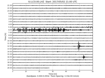
-
IU/LSZ Lusaka, Zambia 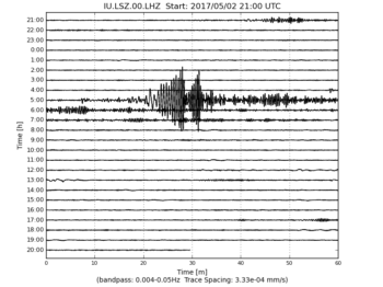
-
IU/LVC Limon Verde, Chile 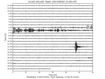
-
IU/MA2 Magadan, Russia 
-
IU/MACI Morro de la Arena, Canary Islands 
-
IU/MAJO Matsushiro, Japan 
-
IU/MAKZ Makanchi, Kazakhstan 
-
IU/MBWA Marble Bar, Western Australia 
-
IU/MIDW Midway Island, USA 
-
IU/MSKU Masuku, Gabon 
-
IU/NWAO Narrogin, Australia 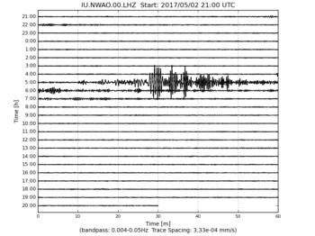
-
IU/OTAV Otavalo, Ecuador 
-
IU/PAB San Pablo, Spain 
-
IU/PAYG Puerto Ayora, Galapagos Islands 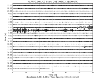
-
IU/PET Petropavlovsk, Russia 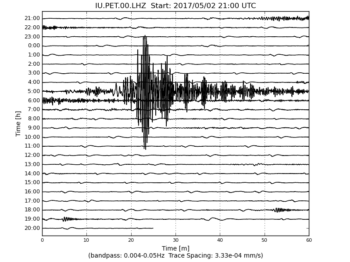
-
IU/PMG Port Moresby, New Guinea 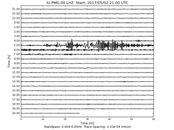
-
IU/PMSA Palmer Station, Antarctica 
-
IU/POHA Pohakuloa, Hawaii, USA 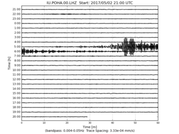
-
IU/PTCN Pitcairn Island, South Pacific 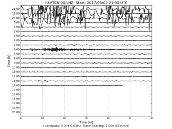
-
IU/PTGA Pitinga, Brazil 
-
IU/QSPA South Pole Remote Earth Science Observatory (Quiet Zone) 
-
IU/RAO Raoul, Kermadec Islands 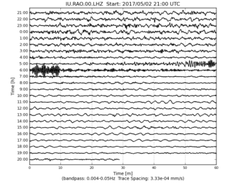
-
IU/RAR Rarotonga, Cook Islands 
-
IU/RCBR Riachuelo, Brazil 
-
IU/RSSD Black Hills, South Dakota, USA 
-
IU/SAML Samuel, Brazil 
-
IU/SBA Scott Base, Antarctica 
-
IU/SDV Santo Domingo, Venezuela 
-
IU/SFJD Sondre Stromfjord, Greenland 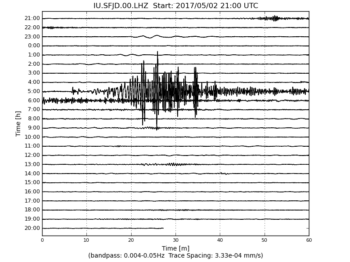
-
IU/SJG San Juan, Puerto Rico 
-
IU/SLBS Sierra la Laguna Baja California Sur, Mexico 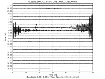
-
IU/SNZO South Karori, New Zealand 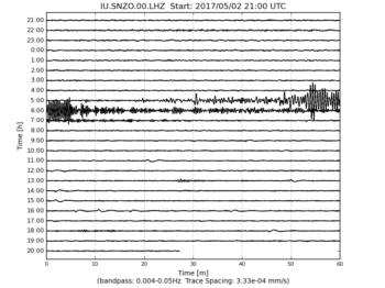
-
IU/SSPA Standing Stone, Pennsylvania 
-
IU/TARA Tarawa Island, Republic of Kiribati 
-
IU/TATO Taipei, Taiwan 
-
IU/TEIG Tepich, Yucatan, Mexico 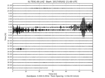
-
IU/TIXI Tiksi, Russia 
-
IU/TRIS Tristan da Cunha 
-
IU/TRQA Tornquist, Argentina 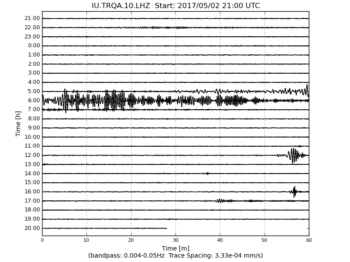
-
IU/TSUM Tsumeb, Namibia 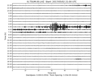
-
IU/TUC Tucson, Arizona 
-
IU/ULN Ulaanbaatar, Mongolia 
-
IU/WAKE Wake Island 
-
IU/WCI Wyandotte Cave, Indiana, USA 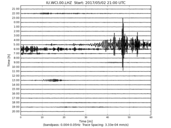
-
IU/WVT Waverly, Tennessee, USA 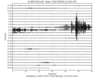
-
IU/XMAS Kiritimati Island, Republic of Kiribati 
-
IU/YAK Yakutsk, Russia 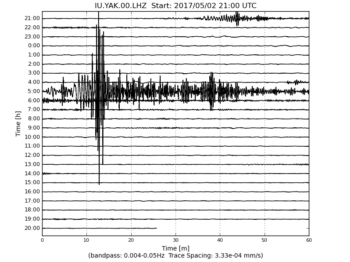
-
IU/YSS Yuzhno Sakhalinsk, Russia 